
Maps – Geographic Information System
Overview
The Federal Railroad Administration (FRA) is the authoritative source of information on passenger and freight rail networks for the U.S. federal government. FRA provides geospatial resources to the public on rail networks, including data on grade crossings, Amtrak stations, and more. This page contains information about and links to FRA's Rail Network, Trespassers Casualty Map, and Grade Crossing Inventory.
FRA publishes geospatial data through the National Transportation Atlas Database (NTAD) hosted by the Bureau of Transportation Statistics (BTS). API tools, such as REST endpoints, can be accessed for each published dataset here: https://geodata.bts.gov/.
Commonly used FRA datasets can be found at the following links:
- Rail Lines -https://services.arcgis.com/xOi1kZaI0eWDREZv/arcgis/rest/services/NTAD_North_American_Rail_Network_Lines/FeatureServer/0
- Rail Points - https://services.arcgis.com/xOi1kZaI0eWDREZv/arcgis/rest/services/NTAD_North_American_Rail_Network_Nodes/FeatureServer/0
- Crossing Points - https://services.arcgis.com/xOi1kZaI0eWDREZv/arcgis/rest/services/NTAD_Railroad_Grade_Crossings/FeatureServer/0
- Rail Yards - https://services.arcgis.com/xOi1kZaI0eWDREZv/arcgis/rest/services/NTAD_Rail_Yards/FeatureServer/0
- Mileposts - https://services.arcgis.com/xOi1kZaI0eWDREZv/arcgis/rest/services/NTAD_Rail_Mileposts/FeatureServer/0/
FRA also provides rail data to the Bureau of Transportation Statistics (BTS) to support the Open Data Catalog, which includes information on the North American Rail Network (NARN).
North American Rail Network (NARN)
FRA developed and maintains the North American Rail Network (NARN) datasets, which accurately represent the rail infrastructure for North America in both lines and nodes layers. A credit to FRA’s dedication and enhancements, the NARN is recognized as a National Geospatial Data Asset (NGDA) and part of the Transportation Theme of the National Spatial Data Infrastructure.
The purpose of FRA’s NARN Lines and Nodes datasets are to promote safety and the national freight rail infrastructure, of which the vast majority is privately owned and operated. To maintain these crucial datasets, FRA employs its own standard for data conformance, simply because the NARN itself is widely recognized as the standard for rail data across government and the public and private sectors. Locate the NARN Standard here: NARN Lines, and Nodes.
Users can locate the NARN Lines and Nodes datasets in the National Transportation Atlas Database.
FRA Rail Network
The FRA Rail Network is an interactive map that outlines rail networks for:
- Class I Railroads
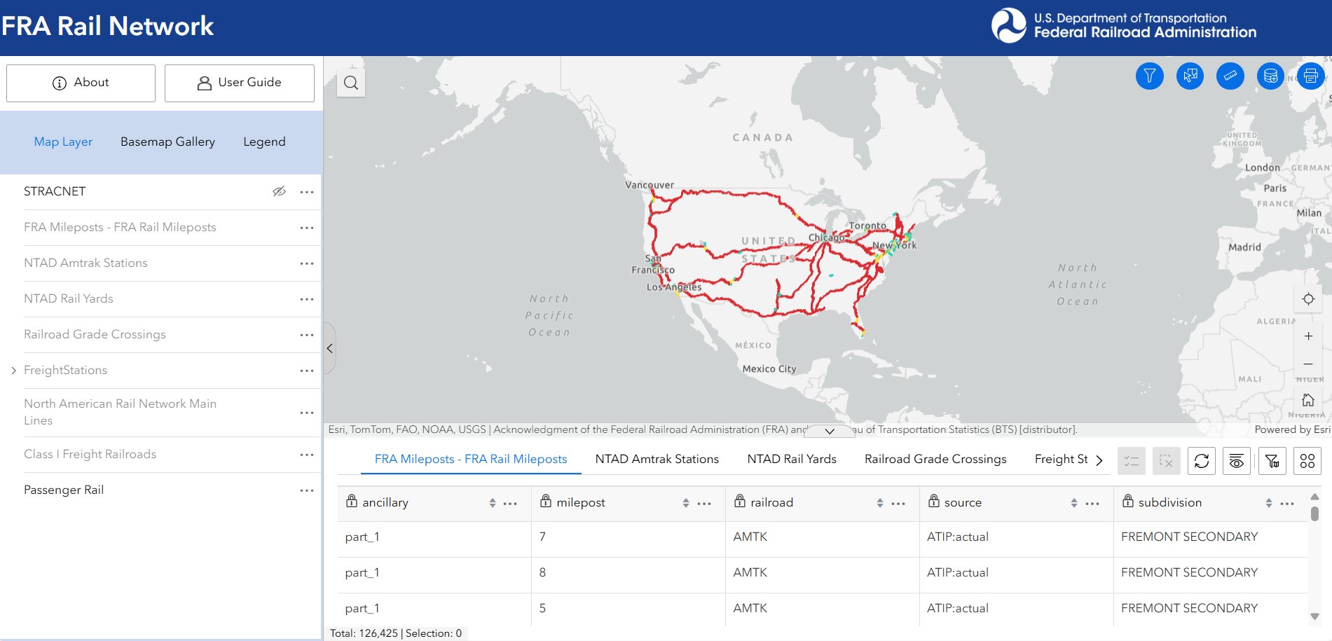
- Passenger Rail
- Commuter Rail
- Amtrak
Users can manipulate data to view maps by topography or street view, and add additional data layers including:
- Freight Stations
- Grade Crossings (updated weekly)
- Mileposts
FRA’s Grade Crossing Inventory provides visual and geographic views of grade crossings. Users can input a Crossing ID and select “Generate Map” to be taken to a custom report. Please refer to the FRA GIS Web Application User Guide for more information.
Trespassers Casualty Map
The FRA Trespassers Casualty Map is an interactive
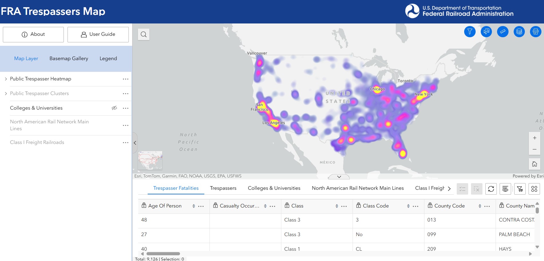
map that displays all railroad trespasser-related injuries and fatalities dating back to June 2011.
FRA aims to increase education, enforcement, and engineering efforts to reduce trespassing on railroad property by providing access to this information.
Similarly to the FRA Rail Network, users have the ability to view maps in multiple forms, as well as add layers, including Class I Railroads and Main Line Rail.
The FRA Trespassers Casualty Map also allows users to view: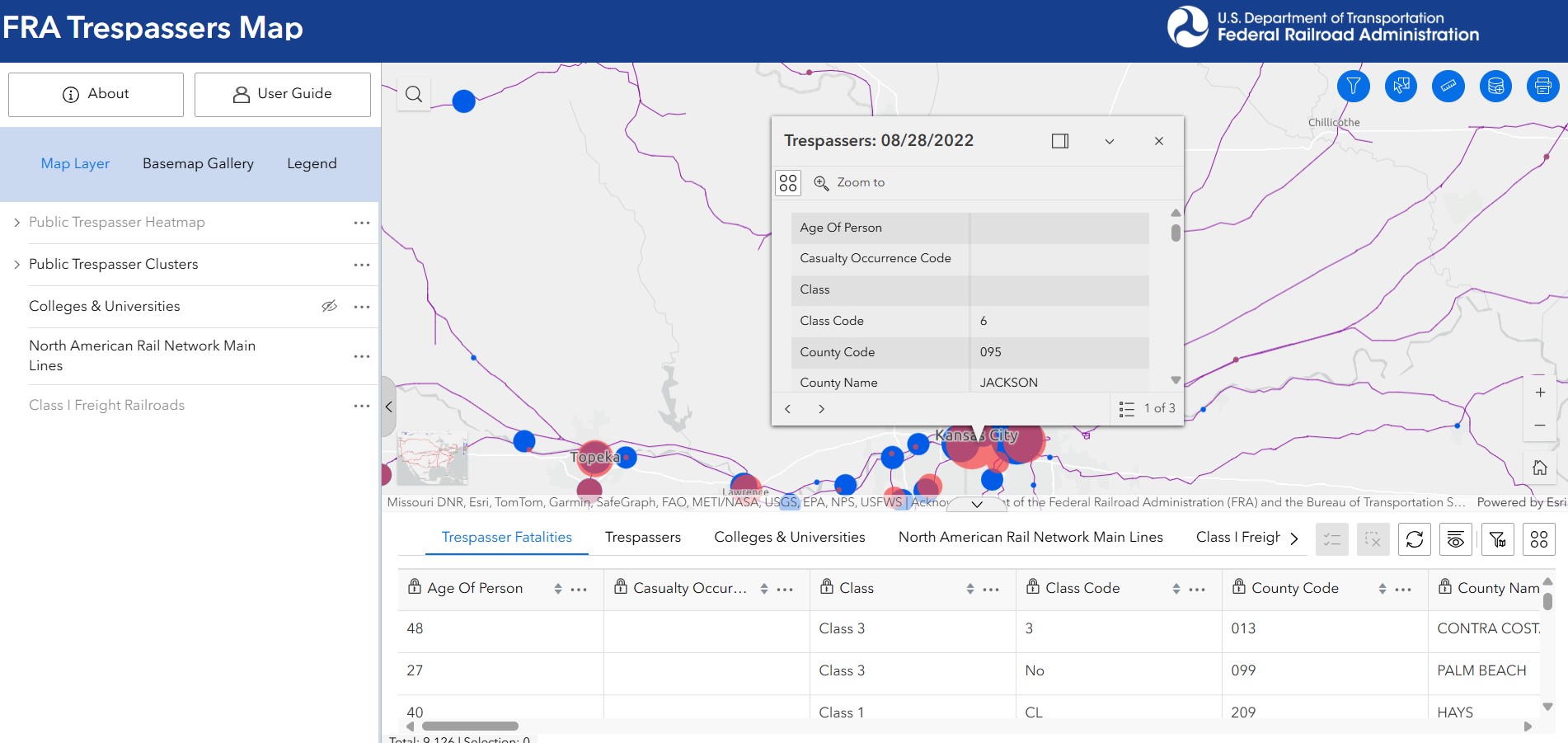
- Where trespassing accidents and fatalities occur
- Trends of where accidents are most concentrated
- Details on what occurred at accident locations
- Outline of Class I Railroad networks
Rail Bridge Map
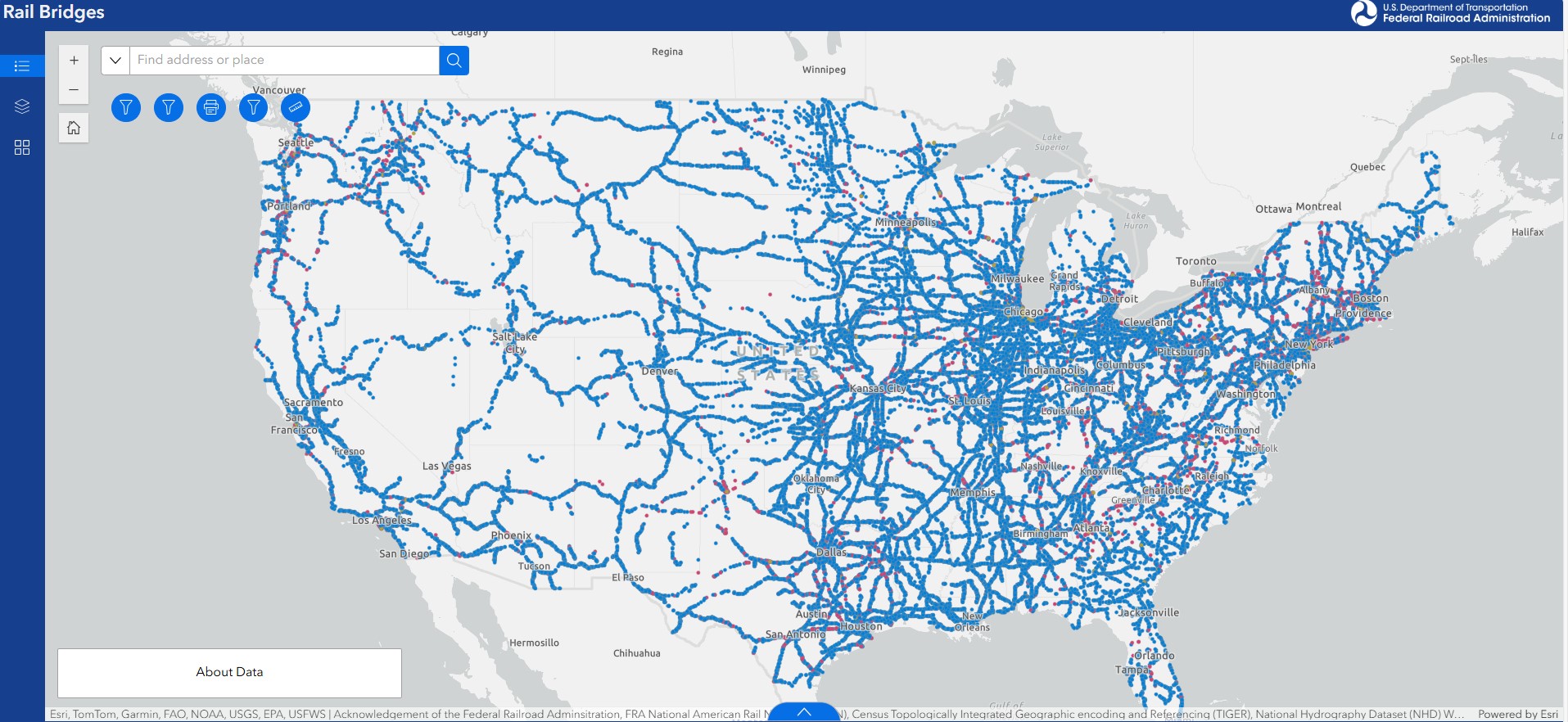 Rail Bridges is an interactive map that displays rail bridges that are Above Water, Above Road, Above Railroad and also displays Under Road. The FRA Bridge Inventory feature layer is a spatial reference file compiled from multiple sources and displays approximate point locations of railroad bridges along the North American Rail Network (NARN).
It is intended for general reference purposes only. The rail lines and bridges are privately owned and may be changed without notice to the FRA. As a result, this file may not reflect current conditions. Users should contact the appropriate railroad to verify bridge types and their locations.
Last updated: Thursday, September 4, 2025